The walk: The England Coast Path down the Western side of Southampton Water and along the Solent to Lymington is very fragmented. The only parts close to the sea are around Calshot Spit, and at Lepe Country Park. Even these two short sections are not connected along the shore, because a section of the beach in between is a designated nature reserve, with no public access, even below the High Water Line. So this walk covers those two 'fragments', from Calshot Village, around the spit and up to the village of Ashlett, and the accessible shore around Lepe.
Map
NB The map shows my GPS track, with various diversions and excursions which you may not wish to follow precisely.
Why do it: Calshot beach. Breezy Calshot Spit, with good views across the Solent and mouth of Southampton Water. The impressive old Sunderland flying boat hangar has been converted to an activity centre which has a cafe (with terrace overlooking the Solent), and there is a lifeboat station and historic Fort/Castle. The walk up to the pretty waterside village of Ashlett is beside Calshot Marshes Nature Reserve on one side, and a wind turbine facility on the other.
Lepe Country Park has an impressive visitor centre with cafe. Lepe Beach has relic D-Day structures and a memorial.
Distance:
Calshot Spit: 6 miles, including excursion West along the beach to the nature reserve boundary.
Lepe Beach: 4 miles (including return walks East and West)
Logistics: For Calshot Spit, I parked in the car park at Calshot village (charge). I walked West along the Beach hoping to reach Lepe, but was blocked by the nature reserve (see above), so I walked back and did the Calshot Spit. I got the bus back from Ashlett, though you could either just retrace your steps, or walk along the road.
For Lepe, I relocated to park at Lepe Country Park (charge), and walked a mile or so either side, and back again.
Challenges:
The marshes between the Spit and Ashlett flood in places at high tide making the path impassable, so best done at low tide. Walking on the shingly beaches can be quite heavy going. Going Westwards from Lepe, the shore path peters out near Inchmery House, and there is no access to the shore of the Beaulieu River; you can either retrace your steps, or come back along the nearby road.
Refreshments: Cafes etc at Calshot village and beach, the Calshot Spit Activity Centre and a pub at Ashlett.
Lepe Country Park has a cafe in the Visitor Centre.
Nearby Walks
To the West: the next section with coastal access is Milford-on-Sea to Lymington
To The East: Bursledon to Woolston
Photos
Calshot
 |
| Cafe terrace, Calshot Activity Centre (formerly, RAF Calshot, centre for flying boats) |
 |
| Calshot beach |
 |
| Heading West along Calshot beach |
 |
| Luttrell's Tower (c1780), part of the Eaglehurst Estate, and now looked after by the Landmark Trust |
 |
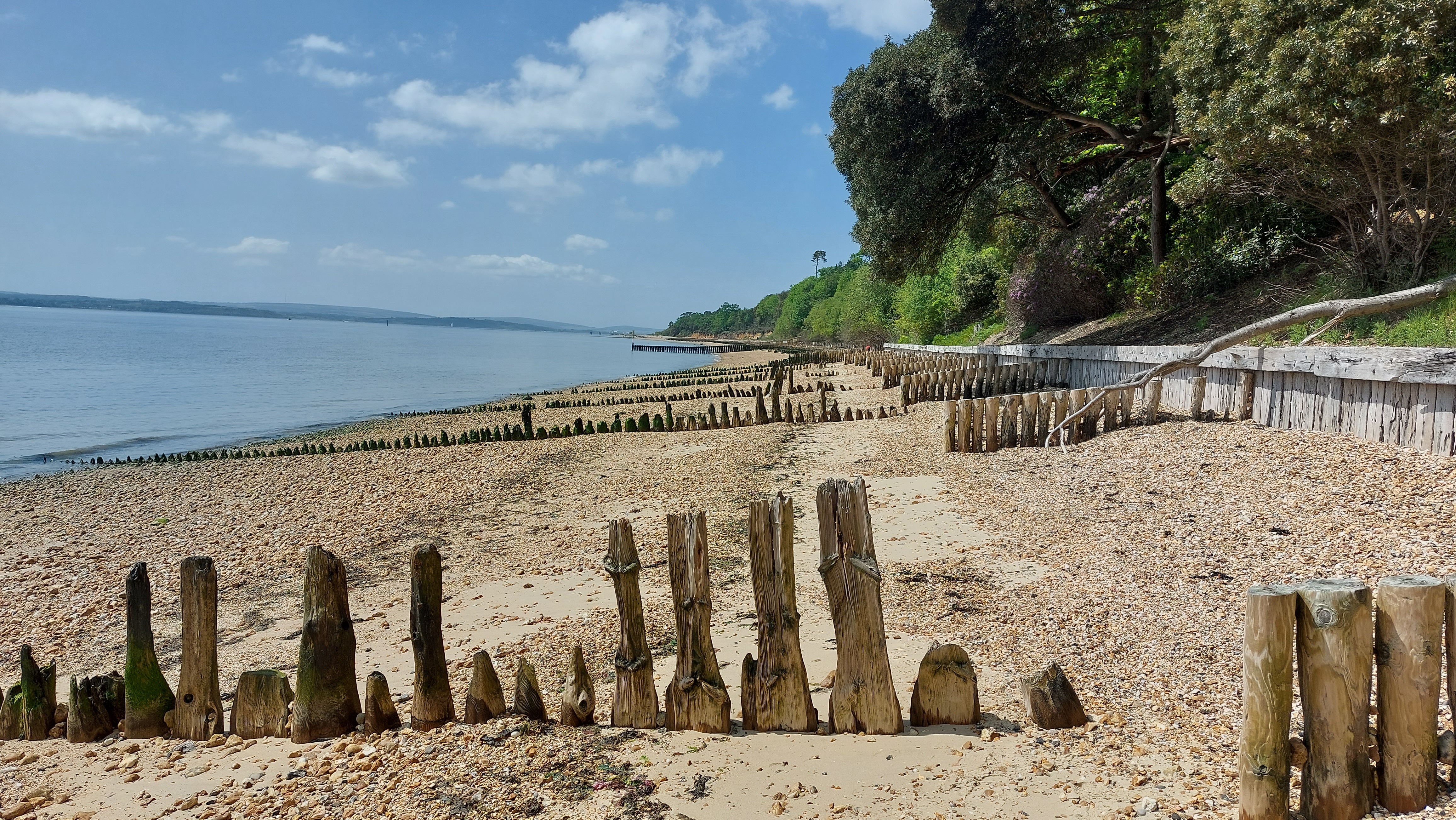
| The beach walk looks promising until.... |
 |
| Walking around Calshot Spit, a mix of sand and shingle |
 |
| The Hangar, once home to RAF flying boats... |
 |
| ...now includes a cafe with a waterside terrace |
 |
| ...whilst the main hangar is now Hampshire County Council's Calshot Activity Centre |
 |
| Calshot Castle, with adjacent Lifeboat Station and National Coastwatch Lookout Station |
 |
| Calshot Castle dates from Tudor times |
 |
| Path entering Calshot Marshes |
 |
| The buildings of Calshot Spit seen across the Marshes |
 |
| The path crosses a swing bridge... |
 |
... and runs beside a wind turbine facility on one side.....
|
 |
| ...and Calshot Marshes on the other |
 |
| Large ships can be seen across the water at Southampton Docks |
 |
| The path floods in places at high tide |
 |
| Ashlett harbour and Mill |
 |
| Pub at Ashlett |
 |
| Rhododendron |
Lepe |
| Ramp descending to Lepe Beach and Visitor Centre |
 |
| One of several car parks at Lepe Country Park |
 |
| Lepe beach, heading East. Isle of Wight visible across the Solent |
 |
| Large ships coming in to Southampton Water |
 |
| Mulberry Harbours were constructed at Lepe |
 |
| 4th/7th Royal Dragoon Guards D-Day memorial: they left from Lepe and were in the vanguard on Gold Beach |
 |
| Lepe was also the starting point for PLUTO - the (oil) Pipeline Under the Ocean |
 |
| Progress Eastwards is barred at the Western end of the beach nature reserve |
 |
| Walking West, the path starts beside the road |
 |
| Looking back to Visitor Centre |
 |
| Lepe House, overlooking the shore |
 |
| The beach is narrow... |
 |
| ...and covered at high tide |
 |
| Walking back along the road |


Comments
Post a Comment