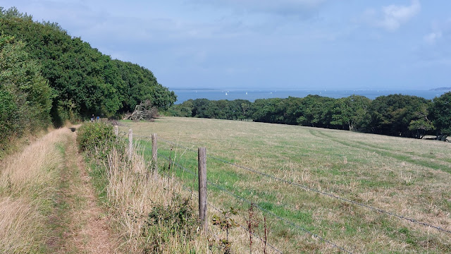
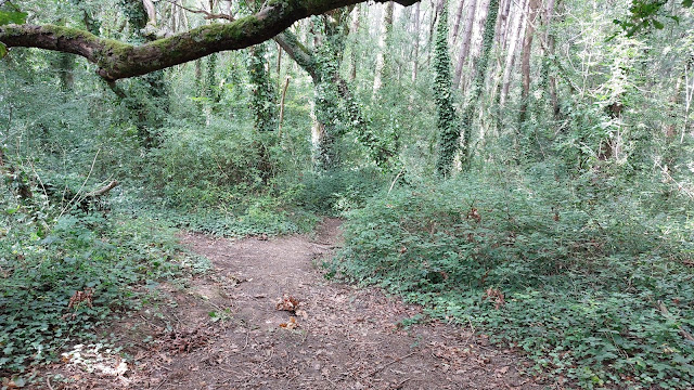
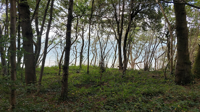
The Walk: Starting from the village of Ningwood on the A3054, the walk follows the Coastal Path around the Western shore of the Newtown River inlet. There is a short section on the Solent beach around Hamstead Point. Then the path runs along the Bouldnor Cliff, before descending to the A3054 again, then follows the sea wall into Yarmouth.
 |
| Solent viewed through a gap in the trees, Bouldnor Cliff |
Route
NB The map shows my route, with various diversions and excursions which you may not wish to follow precisely. BLUE line is Coastal Path, RED line is closed section (2024), GREEN line is diversion, PURPLE line is footpath down to isolated beach, BLACK line is walk to start from Ningwood Old Station bus stop.
Why do it?
This is one for Coastal Path completists.
In other posts, I have described walking the coastal path from Ryde to Yarmouth the long way round via the South coast. In truth, this is more interesting than the section going along the Solent between Ryde and Yarmouth. The former, in the main, stays close to the coast (especially if you try my beach-walk options). The latter spends a lot of time inland, or in trees with limited sea views, and includes quite a lot of road-walking.
I have cycled the Ryde - Cowes - Newtown section, as part of my Six ferries Ride. It is essentially the same as National Cycle Network Route 22, and is mainly road and bridleway. I see little merit in repeating it on foot, except for the Gurnard-Thorness clifftop footpath, although at present (2024), a cliff fall has closed even that section of the path.
So that leaves the current walk, which is largely on footpaths. The best section is the first part around the Western shore of the Newtown River inlet and along the Hamstead beach. The lack of easy parking means that few venture out here, but the views over the river and out across the Solent are well worth the effort.
 |
| Newtown River |
[NB When I did this walk in August 2024, the coastal path between Hamstead Quay and Hamstead Beach was closed (see my Google Map), because the long boardwalks through marshy areas are in an unsafe condition. I walked down to the Quay, then followed an inland diversion to Hamstead Farm (which does offer good views over the Solent as you climb the hill), then followed the coastal path back East to Hamstead Point. Search for 'Isle of Wight Coastal Path Closures' to get the latest news - it may be better to wait until those boardwalks are repaired.]
 |
| Diversion signs |
 |
| Sailors' Memorial |
 |
| Inscription |
 |
| Path around Cranmore |
Actually, the Bouldnor 'Cliff' is more like an earthen bluff, which has progressively collapsed, leaving a wide, impenetrable, undercliff between the 'clifftop' and the sea shore.
 |
| The Bouldnor Undercliff |
Where the descent to the village of Bouldnor begins, an area of heathland has been cleared, giving views along to Yarmouth.
 |
| View towards Yarmouth |
 |
| Bouldnor submerged prehistoric remains |
After a brief spell beside the busy A3045, when you arrive at the Bouldner View car park, you can avoid a trudge along the pavement by taking to the sea wall to reach the vibrant port town of Yarmouth.
 |
| Sea wall to Yarmouth |
Logistics:
I did this walk as a day trip using the Lymington-Yarmouth ferry. Lymington is reached by train (change at Brockenhurst) or car (pay parking next to the ferry terminal)
From the Yarmouth bus stand, I got the Number 7 bus (destination Newport). This runs every half hour in summer, with buses alternating routes via Shalfleet and slightly more inland via Newbridge.
 |
| Yarmouth bus station |
The Shalfleet bus is more convenient, stopping at Hamstead Drive in Ningwood (the footpath follows Hamstead Drive).
 |
| Hamstead Drive |
The Newbridge bus stops at Old Ningwood Station, from which it is a 20 minute walk in total down the road to the Horse and Groom pub, and then beside the A3045 to Hamstead Drive. (NB this is a very busy road so take care on the narrow grass verge).
Distance:
From the Hamstead Drive bus stop back to the Yarmouth ferry terminal by the Coastal Path is 8 miles (with no diversions or excursions).
If the Hamstead diversion is still in place, missing out Hamstead beach, the distance is 7 miles. If you make the excursion down to Hamstead beach and back it adds adds 2.5 miles = 9.5 miles.
In addition I made an excursion on the footpath down through a wood to the beach just after Hamstead Farm: this adds about a mile.
Starting from the Ningwood Old Station bus stop adds to a further mile to the above.
Challenges:
Erosion of the coast and maintenance budgets mean that path closures and diversions are commonplace. Search for 'IOW coastal path closures' for the latest updates.
As aforementioned, the coast path beside the Newtown River is closed (2024) for boardwalk replacement. The diversion path cuts inland direct to Hamstead Farm. Whilst it offers good views back over the Solent, it misses the Hamstead beach. You can follow the coast path back East from the farm to the beach and back again, but this will add some 2.5 extra miles.
 |
| Path closed near Hamstead Quay |
The path along Bouldnor Cliff in summer had an uneven surface of hard baked mud, so probably, after rain, the surface will be gooey unbaked mud. And because of erosion, the path has been moved back considerably off the mapped line, and passes through thorny, scratchy vegetation.
 |
| Scratchy path |
You may be tempted to walk along the Solent beach. However, the beach is muddy at low tide and almost covered at high tide, when the way is barred by fallen trees which litter the shore.
 |
| Tree trunks litter the beach (Purple route) |
Doing the walk as a day trip from the mainland means carefully planning your outward and return journeys. You probably won't reach the start until about midday, which might limit daylight in darker months.
NB I don't think the number 7 bus runs in low season, so check buses on the Vectis website.
Refreshments:
Horse and Groom pub at Ningwood at the start or plenty of pubs, cafés etc in Yarmouth at the end, but nothing in between.
 |
| Horse and Groom pub |
Nearby Walks:
Other walks along the Isle of Wight Coastal Path are described in these posts.
More Photos
Sunny day in late August
 |
| Ferry terminal, Lymington |
 |
| Yarmouth Castle |
 |
| Beside the Newtown River |
 |
| At Hamstead Quay |
 |
| Hamstead Jetty, at Hampstead Quay |
 |
| View over Newtown River Mouth and Solent from diversion path |
 |
| Coastal path down to Hamstead Beach |
 |
| Hamstead Cliffs |
 |
| Hamstead beach |
 |
| Hamstead beach (goes out to Hamstead Spit) |
 |
| Footbridge on the closed path (boardwalks down elsewhere) |
 |
| Coastal path goes along the beach |
 |
| Diversion notice |
 |
| Path near Hamstead West Farm |
 |
| Rough footpath descending through woods (Purple route) |
 |
| Nearing Solent (purple route) |
 |
| Beach near Bouldnor |
 |
| Yarmouth Green |
 |
| Yarmouth |
Comments
Post a Comment