I have walked to the Eastern and Western spits on either side of Pagham Harbour entrance. This walk plugs the gap in between.
From Pagham village, I walked through the Haven Holiday Village, along the North Wall to Sidlesham Quay, and onward to the RSPB Visitor Centre. Since there are no convenient public transport options, I did an 'out and back again' trip. I walked outward in the morning, and it being low tide, I tried to stay along the shore where possible (RED route). I came back in the afternoon at high tide when the shore was flooded, and hence followed the official England Coast Path, which is routed inland where necessary to provide a 'dry' route at all times (BLUE route).
Doing the walk out and back again spanning both low and high tides made the walks different as the harbour basin was largely mud flats and salt marsh on the way out, and a blue lagoon on the way back.
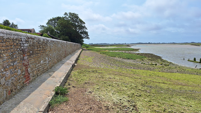
 |
| The shoreline (low tide) route running up to the Salthouse on North Wall |
It's about 4.5 miles each way, so 9 miles in total.
I did actually first do this walk some time ago (March 2023), but both outward (shoreline) and return (ECP) routes were so muddy I couldn't bring myself to grace it with a blog post. This time I did the walk after a summer heat wave, and found the shore sections to be largely dry: the inevitable limited muddy parts left when the tide recedes were easily traversed or avoided. The worst muddy section of the ECP (Eastwards from Halsey's Farm) has been provided with a hard surface.
The shoreline sections are on the Eastern shore of Pagham Harbour, between the Holiday Village and the Salthouse at the Eastern end of the North Wall, and along the Southern Shore between the North Wall and Sidlesham Quay. To follow the shoreline walk, you should of course time your walk to coincide with the period around low tide. In winter, the shore route will still be very muddy, and is best avoided. There are two footpaths providing an escape route back to the ECP (see PURPLE routes on map).
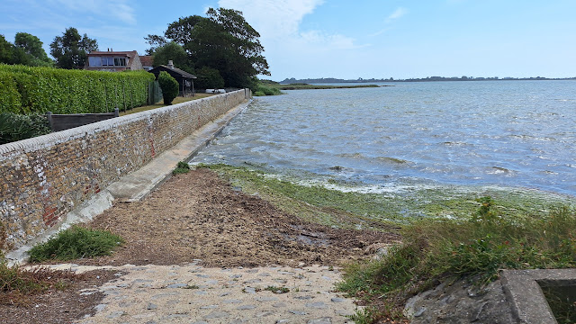
 |
| The shoreline at high tide |
I parked in Pagham. There is a car park opposite the Beach Cafe, which seems to be free at quiet times, £3 at busy times (no machines or pay-by-app details: I think there will be an attendant: check notices).
 |
| Pagham Car Park |
Pagham Harbour is a nature reserve, managed by the RSPB, and plays host to waders and waterbirds, terns and gulls and the occasional peregrine or osprey, although the best viewing will be in winter when large flocks arrive from the North to overwinter. The knowledgeable volunteers at the RSPB Visitor can provide the latest sightings info.
At Sidlesham Quay, now literally a quiet backwater, there used to be a large tidal mill. It was also a halt on the Tramway which linked Chichester to Selsey: the ECP follows the old Tramway to the Visor centre.
For refreshments, try the retro Beach Cafe in Pagham at the start and/or end of the walk, and the Crab and Lobster Pub at Sidlesham Quay for lunch. The RSPB Visitor Centre has a tea/coffee machine.
 |
| Pagham Beach cafe |
This blog covers the walk to the East, from Pagham to Elmer.
This blog covers the walk to the West, a circuit including Church Norton, Selsey Bill and the Medmerry inundation.
Photos
Hot July day, cloudy morning, sunny afternoon, with a cooling breeze
 |
| Beach Cafe, Pagham |
 |
| Walk up Well Road |
 |
| Pagham Holiday Village |
 |
| Becket's Barn: scheduled ancient monument, part of an episcopal palace dating from the 13th Century. Now, somewhat incongruously, repurposed as the reception for the holiday village |
 |
| View over Pagham Harbour |
 |
| Path through holiday village: lodges have nice views over the Pagham Lagoon, a lake separate from the Harbour (maybe old gravel workings?) |
 |
| Leave the Holiday Village and join the ECP |
 |
| ECP on the East side of the Harbour is a good track, but hedges obscure the views of the Harbour. |
 |
| A gate gives access to the shore |
 |
| Shoreside path |
 |
| More shoreside path |
 |
| The shore near the North Wall: low tide |
 |
| Same spot at high tide |
 |
| Salthouse |
 |
| Start of the North Wall path |
 |
| North Wall info board |
 |
| North Wall |
 |
| North Wall |
 |
| Egret Island |
 |
| Egret Island at high tide |
 |
| Shoreside path along the salt marsh |
 |
| Puddles easily avoided |
 |
| Muddy patch |
 |
| Mud in winter! |
 |
| Squelchy patch nearing Sidlesham Quay |
 |
| Crab and Lobster, Sidlesham Quay |
 |
| 'Village Green, Sidlesham Quay |
 |
| Tide Mill info board |
 |
| Tramway info board |
 |
| Tramway path to Visitor Centre |
 |
| RSPB Visitor Centre (winter) |
 |
| Ferry Pool Hide |
 |
| Hide looks over the busy road to the Ferry Pool (good for waders at the right time of year) |
 |
| Tramway heading back beside the now-full Harbour |
 |
| Sidlesham Quay from the Tramway |
 |
| Shoreline path at high tide |
 |
| The ECP resurfaced |
 |
| Previous state of the ECP in winter |
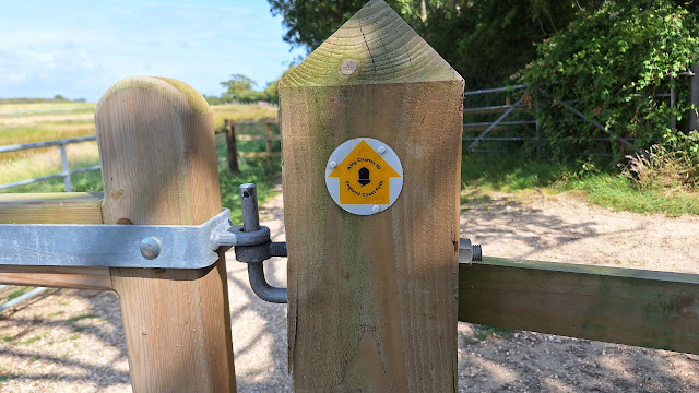 |
| Official ECP marker |
 |
| Looking to the North Wall at high tide |
 |
| North Wall at high tide |
 |
| Towards Harbour entrance at high tide |
 |
| Return route along the ECP |
 |
| Eastern spit boardwalk |
 |
| Seaward side of the Spit |
 |
| Holiday Village across Pagham Lagoon |
 |
| ECP goes along Harbour Road |
 |
| Pagham Beach Cafe |


Comments
Post a Comment