The Walk: A circular from Kingston (near Corfe Castle), outward to Kimmeridge village via the Swyre/Smedmore scarp, down to Kimmeridge Bay, then returning along the Coast path via Houns Tout.
Map
NB The map shows my GPS track, with various diversions and excursions which you may not wish to follow precisely.
Why do it: A satisfying circular route, therefore not requiring transport back to the start. Gently graded walk on a grassy track along the scarp out to Swyre Head then along Smedmore Hill to the village of Kimmeridge, with panoramic views along the coast to the Isle of Portland to the West, St Aldhelms Head to the East, and Corfe Castle and Poole Harbour to the North. Sheltered Kimmeridge Bay, which has a nodding-donkey oil well, rock ledges and a Marine Special Conservation Area. Clavell's Tower (1830), overlooking the Bay. Another dramatic section of the Purbeck/Jurassic coast with banded shale cliffs, culminating in Houns Tout headland.
Distance: 11 miles
Logistics: The route description assumes a start at the free 'Houns Tout' car park at Kingston. There is another car park ('Sheep Pen') about half a mile up the dead end road, and another (Old Quarry) car park above Kimmeridge village, or at Kimmeridge Bay (toll road). The route is described and photographed anticlockwise, but of course could also be done clockwise: this has the benefit that the steep slope of the coast path from Houns Tout is descended, rather than requiring a lung-busting ascent.
Challenges: Several steep ascents and descents, especially the aforementioned ascent of Houns Tout.
Refreshments: The Scott Arms, Kingston (views to Corfe Castle from the garden); Clavells cafe and restuarant at Kimmeridge Village. Snack shack at Kimmeridge Bay.
Nearby Walks
To the West: Lulworth Cove to Kimmeridge
To The East: Kingston to Swanage
For an overview map of all my coast walks see this page.
All my Purbeck walks are listed here.
Photos
 |
| Nodding Donkey at Kimmeridge Bay |
 |
| Houns Tout Car Park |
 |
| Views North to Corfe Castle and Poole Harbour |
 |
| Road from Houns Tout car park to.... |
 |
| ... start of path at Sheep Pen car park |
 |
| Views across to Swyre Head (right) and Houns Tout (left) |
 |
| Grassy track up to Swyre Head |
 |
| St Aldhelm's Head from Swyre Head |
 |
| View over to Kimmeridge Bay from Swyre Head, with white cliffs of Lulworth ranges beyond, and Isle of Portland to the left. |
 |
| Path towards Smedmore Hill (tumulus to right) |
 |
| Purbeck dry stone wall |
 |
| From Smedmore scarp |
 |
| On Smedmore Hill scarp |
 |
| Lots of butterflies (Peacock?) |
 |
| Descending towards Kimmeridge. It is possible to continue along the ridge in the middle distance, but only when the Ranges are open. |
 |
| Kimmeridge village and Bay |
 |
| Clavells cafe in Kimmeridge |
 |
| Info boards |
 |
| Snack shack at Kimmeridge |
 |
Nodding Donkey
|
 |
| Ledges at Kimmeridge Bay |
 |
| Kimmeridge Bay, overlooked by Clavell's Tower |
 |
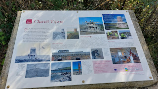
| Clavell's Tower |
 |
| The ledges along the coast are probably exposed at low tide, not today though |
 |
| Coast path |
 |
| Smedmore Hill scarp in background |
 |
| The path runs close to the cliff edge in places, and is subject to erosion |
 |
| Rope Lake Head |
 |
| Kimmeridge Ledges (covered at high tide, inaccessible from cliff top, although I believe they can be reached along the shore) |
 |
| Most distant headland is St Aldhelm's Head, next most distant is Houns Tout |
 |
| Banded shale cliffs |
 |
| Swyre Head on the right |
 |
| Approaching Houns Tout |
 |
| View from Houns Tout |
 |
| Craggy Houns Tout |
 |
| Grassy track back to car park |


Comments
Post a Comment