The Walk: From Lulworth Cove, this walk is a blend of Range Walks, coastal path and finally the airy Purbeck Ridge to Corfe Castle. The walk is only possible when the MOD Lulworth Ranges are open to the public. There is an optional excursion down to the abandoned village of Tyneham. (Part 2 continues from Corfe Castle to Old Harry Rocks, making for a complete traverse of the Isle of Purbeck.)
 |
| Corfe Castle ruins seen from the West Hill viewpoint |
Route
NB The map shows my route, with various diversions and excursions which you may not wish to follow precisely. You can download the Google map info, as a KML/KMZ file, then convert to GPX using a site like GPS Visualiser.
The main route is the BLUE line, including the excursion to Tyneham.
The GREEN route is the excursion up to the Western headland of Lulworth Cove
The RED route is the excursion to Creech Barrow Hill.
The PURPLE and ORANGE routes East of Corfe Castle cover Part 2 from Corfe Castle to Old Harry Rocks and Swanage, covered in a separate blog.
From the Lulworth Cove Visitor Centre, it is worth ascending to the Western headland of the Cove for excellent views of the Cove, and also adjacent Stair Hole.
Then, take the inland diversion of the Coastal Path and head up Bindon Lane then shortly take a footpath signed to the Right. Instead of following the lower Coastal Path, head steeply diagonally up across the downland slope to enter the Range through a gate atop the Bindon Hill Ridge.
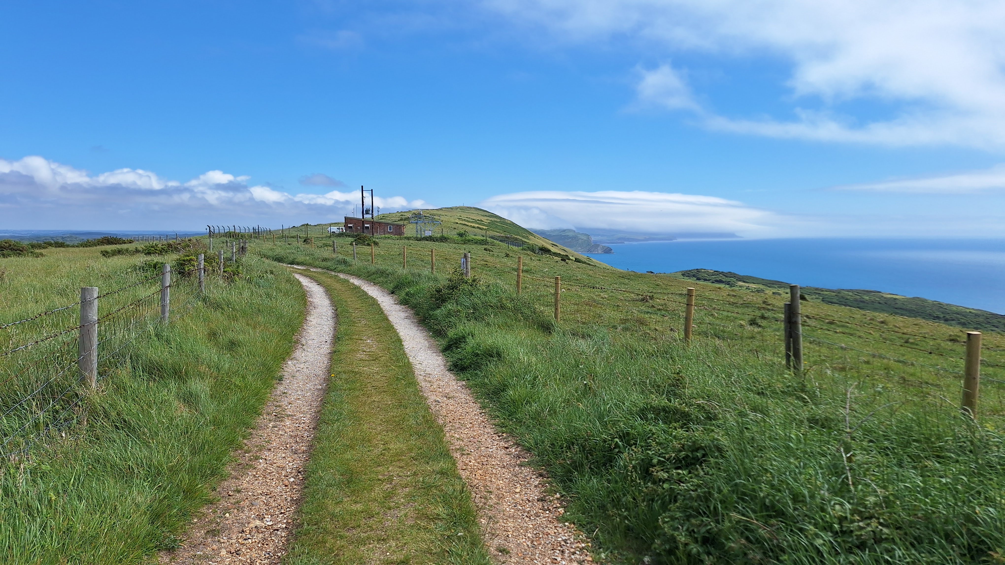
Follow the track along the ridge, passing a telecoms mast and continuing to join the official SW Coast Path above Mupe Bay. Descend to Arish Mell Bay then make the relentless climb up to Flowers Barrow headland.
The walk then avoids the steep descent to Worbarrow Bay by exiting through a gap in the hill fort ramparts on the track heading East along the ridge passing the trig point on Whiteway Hill and reaching the tarmac lane. Here you can
- EITHER continue along this road, passing the Whiteway Hill car park to arrive at the Isle of Purbeck Viewpoint car park (there is a separate path beside the road for most of the way)
- OR descend on a stony track to visit the abandoned village of Tyneham, then climb back up the village approach road to rejoin the above route (Tyneham village should be open if the Range Walks are open)
At the eastern end of the viewpoint car park, a permissive track continues due East along the Purbeck Ridge, soon passing the Grange Arch and eventually descending alongside the dry valley which is the Stonehill Nature Reserve.
(NB at the top of the Stonehill Valley, an obvious outlying hill can be seen to your left (North): this is Creech Barrow Hill: the eponymous barrow on the summit is an excellent view point, which can be reached on a 1 mile round trip excursion.)
Cross a tarmac lane rising from Church Knowle and continue along the ridge track, where the Ridge becomes West Hill. The top of the ruined keep of Corfe Castle comes into view. Instead of taking a track branching off downhill to the right, continue along the ridge on a permissive path and ascend across the downland to the viewpoint on the Western bluff of the gap in the ridge. There is an excellent view of Corfe Castle ruins in the gap below.
Descend steeply to pick up a well made path: turn right to the village and castle entrance, or left to the NT car park, if that is where you have left your car.
Why do it?
Before starting the main walk, it is well worthwhile ascending to the West headland of Lulworth Cove for the excellent view of the Cove itself and also adjacent Stairs Hole.
 |
| Lulworth Cove from the West headland |
This walk, and Part 2, follow the Purbeck Ridge, a distinctive chalk ridge which spans from Bindon Hill and Flowers Barrow in the West, arcing across country via the gap at Corfe Castle to regain the coast in the East at Old Harry Rocks, forming a sort of 'back wall' to the Isle of Purbeck.
 |
| The Purbeck Ridge, Stonehill dry valley to the left, West Hill ahead |
The first part of this walk is a variation of my walk to Kimmeridge, which sticks solely to the coastal path. The Range Walks along the ridges of Bindon Hill and Whiteway Hill afford excellent views along the coast, to St Aldhelms Head in the East and the Isle of Portland in the West, and also inland over the Dorset Heaths.
 |
| On Bindon Hill, St Aldhelm's Head shrouded in cloud |
The coastal sections afford fine views of the cliff scenery around Mupe Bay, Arish Mell and Flowers Barrow (the latter is an iron age hill fort).
 |
| Mupe Bay from Bindon Hill |
The village of Tyneham was compulsorily acquired by the military in 1943 for wartime training. The residents were 'relocated', but contrary to assurances given at the time, were never allowed to return. The evocative abandoned, largely ruined, buildings can be visited when the Range Walks are open. The church remains in tact, there is an informative display in the old schoolhouse, and a mobile kiosk sells refreshments.
 |
| Vintage telephone box, Tyneham |
The isle of Purbeck Viewpoint in the Creech Hill Car Park does what it says on the tin.
 |
| Isle of Purbeck Viewpoint car park |
Grange Arch is an 18th century folly built to frame views of the Creech Grange mansion at the bottom of the hill (though vegetation now obscures that sightline).
 |
| Grange Arch |
The Ridge from Grange Arch to West Hill affords excellent views across the Isle of Purbeck, culminating in the view over the ruins of Corfe Castle.
 |
| Looking towards Swanage, Nine Barrow Down to the left |
The ruins (NT, free entry to members) have been described as 'the most romantic ruins in Britain', with a colourful history of defiance by the Royalist owners in the Civil War, followed by 'spoilation' by Parliamentary forces upon their final victory.
 |
| Corfe castle ruins as seen on descent from the West Hill viewpoint |
The adjoining village is quaint, with houses of Purbeck stone including heavy stone roof tiles.
Logistics:
The walk as far as the Isle of Purbeck viewpoint can only be done when the MOD Range Walks are open to the public, which is generally most weekends, with some longer periods during school holidays. Check on line by googling 'MOD Lulworth Range Walks' or similar.
The walk is greatly facilitated by the Purbeck Breezer bus service No 30 between Corfe Castle and Lulworth Cove via Wareham and Wool: the Breezer buses form a network of routes which are very handy for walkers in the Isle of Purbeck from Weymouth to Bournemouth, but only run in summer months: check timetables on line.
Start: Lulworth Cove visitor car park and visitor centre.
Finish: Corfe Castle
Possible options include (there are endless permutations):
- Park at the NT Visitor Centre car park at Corfe Castle (free to NT members). Take the No 30 Breezer bus from outside the car park (or in East Street in the village) to Lulworth Cove and walk back.
- as (1) but walk to Lulworth and get the bus back (you need to decide whether it's more convenient to get the bus trip over at the beginning or end of the day)
- Park at Lulworth Cove (charge) and use bus as above
- By train: get a train to Wareham, and take the No 30 Breezer bus to Corfe Castle or Lulworth Cove (the bus calls at Wareham station).
- As 4 but Wool station instead of Wareham.
As well as the NT Car Park in Corfe Castle, there is a 'Park and Ride' car park at Norden Station (Charge), and a pay car park off West Street in the village. People also attempt to park for free on the various minor roads leading into the village.
 |
| Breezer Bus at Lulworth Cove |
Distance: Main route: 12 miles
Excursion to West headland of Lulworth Cove adds half a mile.
Excursion to climb Creech Barrow Hill adds one mile round trip.
Challenges:
As aforesaid, the MOD Ranges must be open to the public. As well as checking online, there are signs along the main approach roads. You must stay on the designated tracks, as marked by yellow posts. These tracks are regularly checked for unexploded munitions and kept clear.
 |
| Range status boards on the approach roads |
The Breezer buses only run in summer months.
There are steep ascents and descents along the coastal sections of the route, and also the final descent from the Corfe Castle Viewpoint. In addition, in winter or after heavy rain these might be slippery.
As with any coastal area, there is a risk of sea mist rolling in, particularly on humid days.
Corfe Castle is a tourist honey pot in high season, and is also a traffic bottleneck. Take care crossing the roads in or near the village.
Refreshments:
Corfe Castle has numerous pubs and cafes, though most do not open much before 10am. You could try the Bankes Arms for coffee/breakfast, and the Village Bakery for fresh filled rolls and takeaway coffee.
Lulworth Cove has several eateries around the visitor centre.
A mobile kiosk operates when Tyneham village is open, but usually closes at 3pm, earlier if they run out stuff.
 |
| Mobile kiosk at Tyneham (closed early because it had run out of water) |
Nearby Walks:
For an overview map of all my coast walks see this page.
All my Purbeck walks are listed here
To the West: Weymouth (Cowleaze) to Lulworth Cove
To the East: Purbeck Ridge Part 2: Corfe Castle to Old Harry Rocks
Also, Lulworth Cove along the coast path to Kimmeridge
More Photos
Late May, sunny start, misty middle, sunny finish
 |
| Cafe at Lulworth Cove visitor car park |
 |
| Cliff fall blocks Lulworth Cove beach |
 |
| West headland |
 |
| Stairs Hole |
 |
| Coast path is diverted inland |
 |
| Fork left for climb to Bindon Hill |
 |
| The track in the opposite direction to Durdle Door, always busy |
 |
| Exmoor pony |
 |
| Range entrance on Bindon Hill |
 |
| Looking back on Bindon hill, Isle of Portland to the left |
 |
| Lulworth Army Camp |
 |
| Towards the end of Bindon Hill. Flowers Barrow and Whiteway Hill come next |
 |
| Royal Armoured Corps memorial on Bindon Hill |
 |
| Path ascending from Mupe Bay joins over stile |
 |
| Path along the cliff edge |
 |
| Flowers Barrow in mist/cloud |
 |
| Looking back to Mupe Bay |
 |
| Arish Mell, path climbing to Flowers Barrow |
 |
| Looking back to the steep descent from Bindon Hill |
 |
| The steep climb up to Flowers Barrow |
 |
| Peep into Worbarrow Bay |
 |
| Lulworth Castle from Flowers Barrow |
 |
| The ramparts of Flowers Barrow iron age hill fort: exit through the gap left of centre |
 |
| We avoid a steep descent to Worbarrow Bay |
 |
| Exit from Flowers Barrow hill fort |
 |
| Trig point on Whiteway Hill |
 |
| The track from Whiteway Hill, range road in the distance |
 |
| Track down to Tyneham. Little hill is Warbarrow Tout headland, Isle of Portland to the right |
 |
| Approaching Tyneham |
 |
| Tyneham Church |
 |
| Echoes of times past |
 |
| Ruined houses |
 |
| Tyneham access road |
 |
| There is a footpath beside the Whiteway Road |
 |
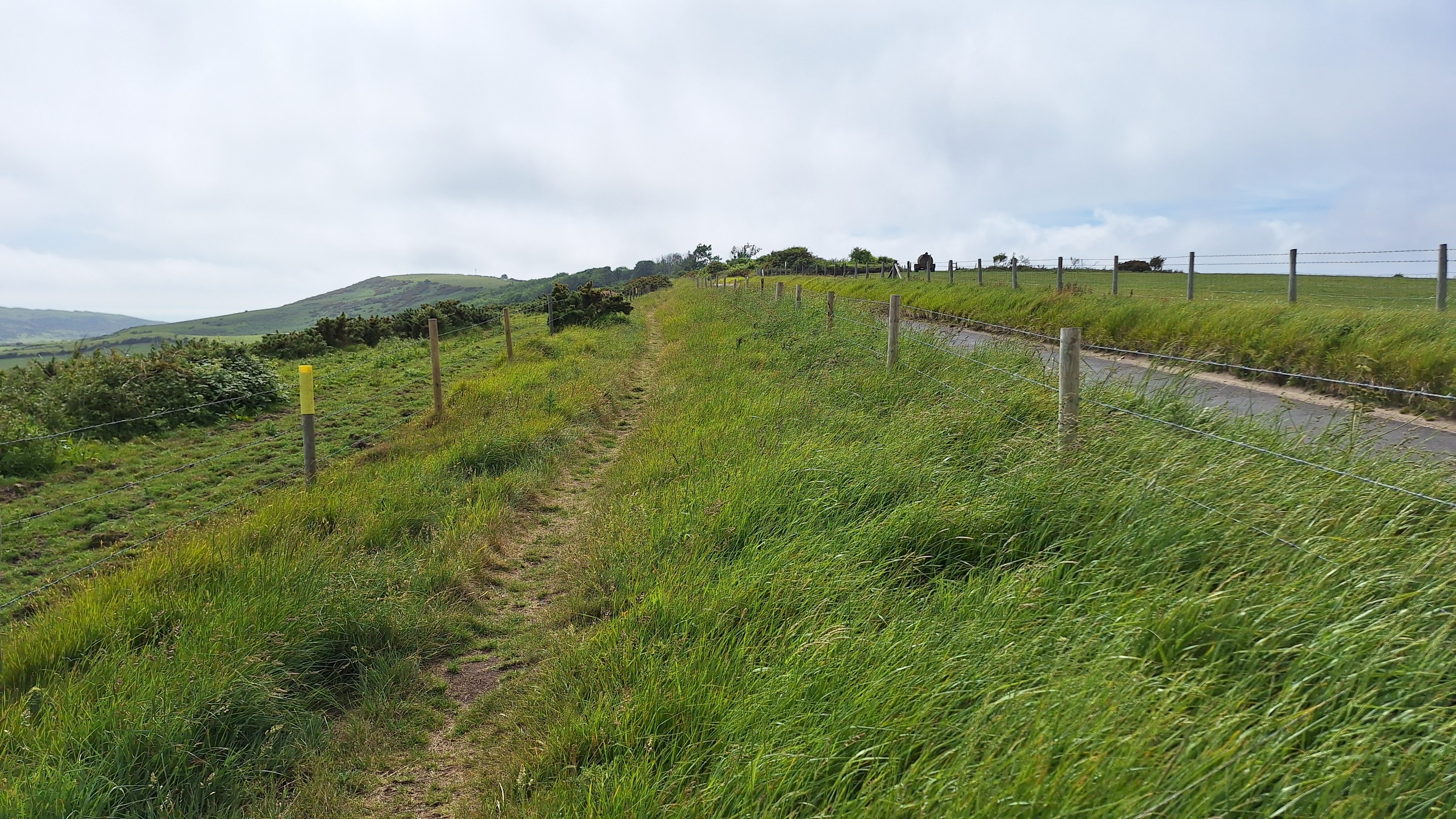
| Start of the track along the Purbeck Ridge |
 |
| Creech Barrow Hill, seen from Stonehill |
 |
| On top of Creech Barrow Hill |
 |
| Creech Barrow Hill, looking towards Swanage |
 |
| The track heads down beside the Stonehill dry valley |
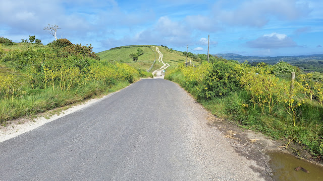 |
| Brief interlude on the Church Knowle road, West Hill ahead |
 |
| The crest of West Hill |
 |
| Looking back from West Hill |
 |
| Poole Harbour comes into view |
 |
| Track branching down to Corfe. Best to carry straight on along the downland |
 |
| Top of Corfe Castle's ruined keep comes into view |
 |
| Path down from West Hill viepoint |
 |
| The Ruins |
 |
| Path back to the NT Corfe Castle Car park |


Comments
Post a Comment